![]()
|
|
In 2002, the Nisqually Indian Tribe conducted the second part of their intertidal habitat restoration program on Nisqually Delta. Shortly after, the Nisqually Reach Nature Center began, in cooperation with the Tribe, a long term bird monitoring program to complement the Tribe's monitoring program elements.
The two restoration
sites form a contiguous "L-shaped area" between the Nisqually
River and
Our bird monitoring goals are to learn how bird use of the restoration site evolves in concert with vegetation colonization. As our capabilities improve, we also want to learn how bird use of this intertidal habitat compares with bird use of similar habitats on Nisqually Delta and other estuaries in south Puget Sound.
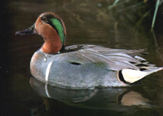
Bird use of the restoration tide flats is greatest as the rising tide covers the tide flats: in season, waterfowl arrive to drift on the tide waters as they feed, dabbling and ducking for seeds and other food. Shorebirds, which probe the mud just in front of a rising tide, are "pushed" by rising tide waters from the Nisqually Flats into high intertidal areas such as our monitoring site. Seasonally, we find distinct patterns of bird species, populations, and habitat use during the spring migration, summer, fall migration, and over-wintering seasons. Read the protocol we follow on a typical monitoring visit.
|
|||
|
|
||||
|
|
||||


 Red Salmon Creek. Together they total 50 acres. Their
elevation ranges from 15 feet to 8 feet (0 = mean lower low
water, or the "zero tide"). The restoration sites are tide flats
with an uneven surface which is rapidly being colonized by upper
intertidal plant species from adjacent areas. The dominant
colonizers are Salicornia virginica (Pickleweed,
Glasswort), and Distichlis spicata (Seashore Saltgrass).
Due to the uneven topography, tide pools remain behind the
ebbing tide waters. To the south and east of the restoration
site are high salt marshes dominated by Distichlis spicata
(plus other species), and cut by numerous meandering sloughs
draining east to Red Salmon Creek. On the west and north is the
Nisqually River dike (elevation 18 to 19 feet); a mature
riparian forest dominated by Black Cottonwood, Red Alder, and
Oregon Ash lies between the dike and the river.
Red Salmon Creek. Together they total 50 acres. Their
elevation ranges from 15 feet to 8 feet (0 = mean lower low
water, or the "zero tide"). The restoration sites are tide flats
with an uneven surface which is rapidly being colonized by upper
intertidal plant species from adjacent areas. The dominant
colonizers are Salicornia virginica (Pickleweed,
Glasswort), and Distichlis spicata (Seashore Saltgrass).
Due to the uneven topography, tide pools remain behind the
ebbing tide waters. To the south and east of the restoration
site are high salt marshes dominated by Distichlis spicata
(plus other species), and cut by numerous meandering sloughs
draining east to Red Salmon Creek. On the west and north is the
Nisqually River dike (elevation 18 to 19 feet); a mature
riparian forest dominated by Black Cottonwood, Red Alder, and
Oregon Ash lies between the dike and the river.