|
So What’s Different now that Nisqually Reach is an Aquatic Reserve?
By Doug Myers 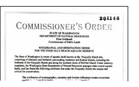 On Friday, September 9, 2011, Commissioner of Public Lands Peter Goldmark signed the Nisqually Reach Aquatic Reserve Order and Management Plan. This was quite an achievement and well deserving of celebration: the culmination of four years of hard work by Center staff and by board members and volunteers who spent countless hours collecting data, writing and rewriting drafts of management plan language for discussion with stakeholders, and navigating some of the internal politics of the Department of Natural Resources (DNR). But now that the pomp and circumstance has stopped, what does the Aquatic Reserve’s designation really mean?
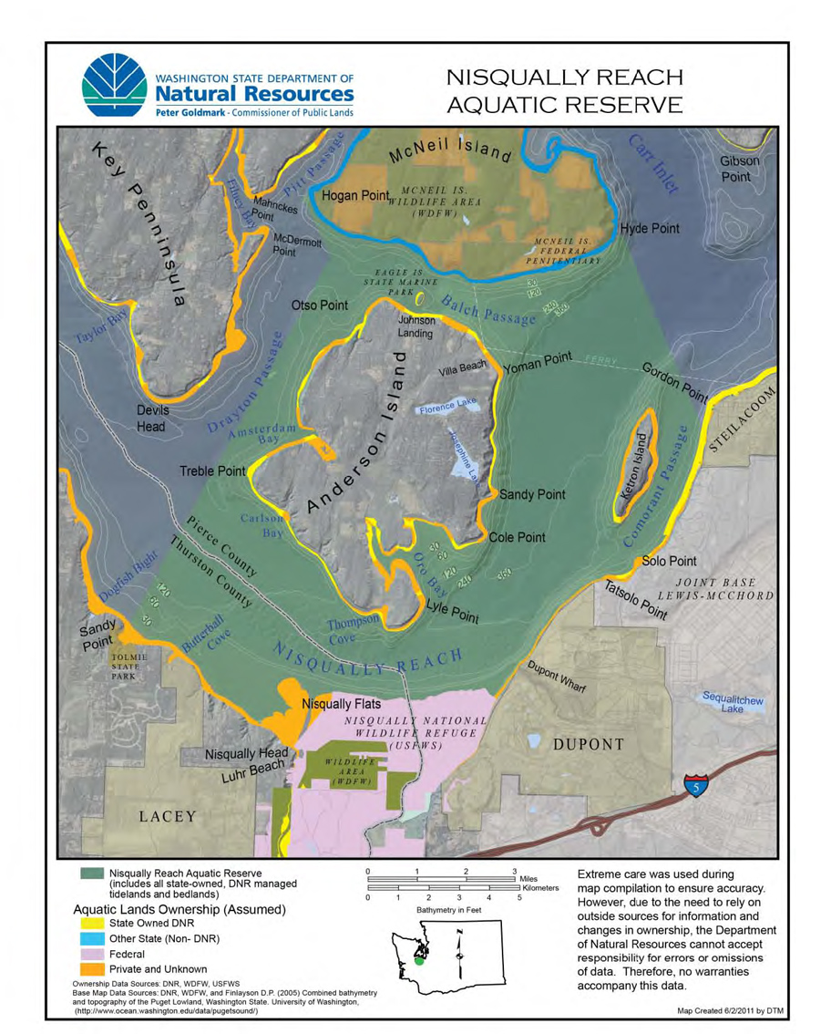
Well, the advantages started accruing early, during the last year of the nomination process, when DNR forwarded the reserve management plan for formal consideration to the Commissioner. This action triggered a hold on all new lease decisions within the reserve boundary until the management plan was in place. In addition, ongoing monitoring projects associated with the delta restoration took on a broader focus as the U.S. Geological Survey (USGS) began coordinating data collection efforts with Center Director Daniel Hull on the bathymetry and grain size of the benthos (bottom sediment) beyond the submarine delta. This study will help to narrow search grids for later SCUBA and Remotely Operated Vehicle characterization of benthic habitats and species. Local volunteer divers began to coordinate dive locations to describe the fish, invertebrates, algae species and other characteristics of the USGS data collection sites.  The reserve designation also enabled DNR to bring new funding for a comprehensive fish use survey by expanding the Nisqually Tribe’s ongoing fish use survey of the delta and nearby shorelines to the entire aquatic reserve and beyond, even to the other shorelines of McNeil Island.
The Center has attracted new potential donors that appreciate the work we do and the excitement the aquatic reserve brings. Organizations and agencies around the reserve are better partnering and communicating with us about issues that might positively or negatively affect the reserve. The Anderson Island Parks Board provided funding to acquire undeveloped land in Oro Bay on Anderson Island in part because of the positive effect the acquisition would have on protecting habitats and species within the reserve.
The reserve designation also enabled DNR to bring new funding for a comprehensive fish use survey by expanding the Nisqually Tribe’s ongoing fish use survey of the delta and nearby shorelines to the entire aquatic reserve and beyond, even to the other shorelines of McNeil Island.
The Center has attracted new potential donors that appreciate the work we do and the excitement the aquatic reserve brings. Organizations and agencies around the reserve are better partnering and communicating with us about issues that might positively or negatively affect the reserve. The Anderson Island Parks Board provided funding to acquire undeveloped land in Oro Bay on Anderson Island in part because of the positive effect the acquisition would have on protecting habitats and species within the reserve.The reserve management plan lays out many next steps for implementation. The Center, DNR, and our many other partners will continue to look for new collaborations, funding sources, and volunteer support to implement the plan. The investment of the Nisqually Reach Nature Center in nominating the aquatic reserve is beginning to pay dividends. Please consider how you can be a part of protecting one of Puget Sound’s most special places, investigating the mysteries of the deep in our own back yard, and teaching the next generation. 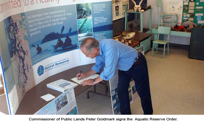 |
      |
|
Nisqually Reach Nature Center. 4949 D'Milluhr Drive NE. Olympia WA 98516-2311. (360) 459-0387. [email protected] |
Left: Commissioner of Public Lands Peter Goldmark signs the Aquatic Reserve Order. |
|